Cantinho do Céu Complex
The design of the Cantinho do Céu Complex represents the overcoming of a way of thinking about public space and the relationship residents have with the neighborhood, the region where they live and the city as a whole. The project add value to all efforts to build the city, from the perspective of an upgrading project designed in coherence with diversity.
The Programa Mananciais (Water Source Program) has assisted the settlements fixed in water source protection areas surrounding Guarapiranga and Billings reservoirs, located in the south of São Paulo, supplying 3 million inhabitants. The program aims to restore water quality, to promote an urban intervention that is adequate for the environment, and to improve the quality of life of the local population. The program's actions are the result of integrating the three spheres of government – Municipal, State, and Federal – in addition to utility concessionaires and other civil society actors. Currently, the Municipal Housing Secretariat (Sehab) has been developing 91 projects in these regions, which cover about 100,000 families.
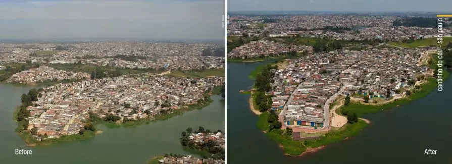
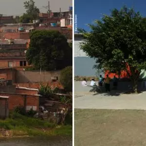
In the specific case of Cantinho do Céu Complex (comprising three neighborhoods in the Grajaú region, south of the city of São Paulo: Parque Residencial dos Lagos, Jardim Gaivotas and Cantinho do Céu), the irregular occupation of the area occurred in the late 1980s, on the banks of the Billings reservoir. As a result, there was a negative impact on the environment and on the preservation of the hydrographic basin, due to lack of infrastructure and public facilities.
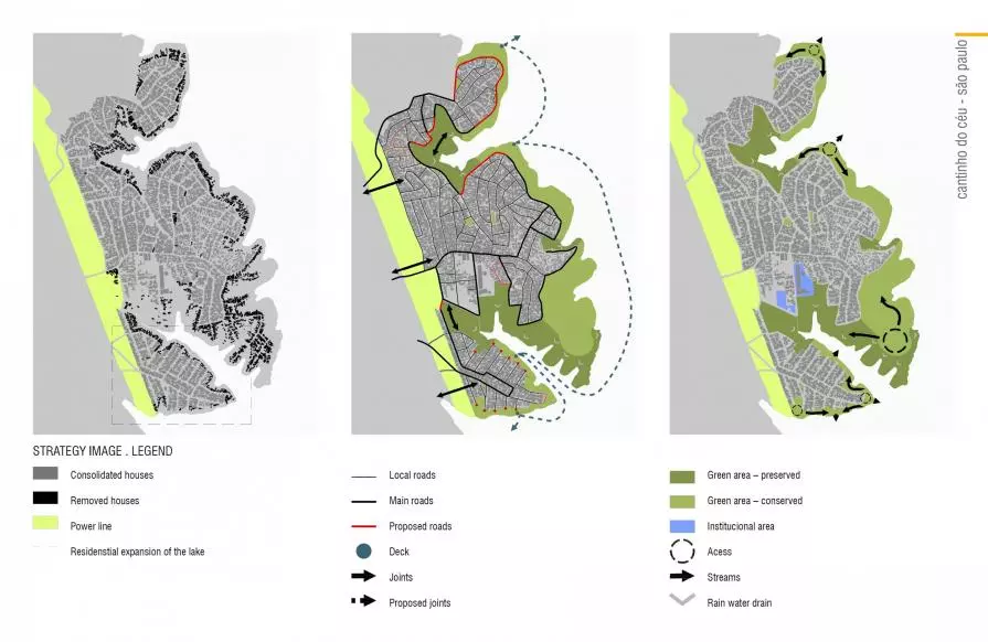
The proposal started from the articulation of the main access routes to the residential area, consolidating the road network by means of a hierarchy, in which the organization of the traffic flow could enhance public transport and services, and successively, balance the transit of cars, motorcycles, cyclists, and pedestrians. In the context of environmental preservation, such as the guarantee of soil permeability, the paving of the road system according to the defined type of traffic is premised on projects in the water source areas.
The implementation of other infrastructure networks complemented the intended action, with the sewage collection and disposal, drainage network, geotechnical consolidation, and enhancement of remaining spaces.
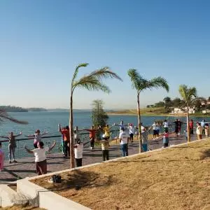
Inside the upgrading project, a system of open areas with about 7 km long is noticeable, where a linear park is deployed, providing a set of public open spaces of regional scale. The free space acts as a system of green areas, combining recreation and leisure uses to the preservation of the margin, with the maintenance and restoration of autochthon species. The park appears as a borderline land strip of collective appropriation between the occupied area and the reservoir.
The upgrading project has adopted as one of its main strategies to improve the free public spaces. For this, the project created a system of green areas, with local approach and transition from urban area to the edge of the reservoir, making the waterways free, both by the eviction from their margins, and by preserving the water springs.
In order to meet the requirements of environmental legislation, criteria for compensation and equivalence of green areas on indexes defined by law were used, balancing the system of public spaces as a result of the actions for processing and improvement of the territory proposed in the urban plan.
Other solutions have been adopted such as the use of overhanging wooden structures (certified and controlled source), creating decks, walkways, and ”living” areas. The chosen floor material has a high rate of permeability (about 90% of infiltration capacity), having a set of micro drainage devices along with its supporting base that help retention and infiltration of rainwater. Also a concept of green infrastructure has been applied in a pilot area, which articulates the relief’s specific conditions with the water running, retention, and infiltration devices, which we call "Rain Garden".
All these sustainability aspects of the project were further enhanced by the composition of defined recreational spaces for the population, such as sports fields, skating rinks, fitness equipment, and an outdoor cinema. These interventions have transformed the residents’ routine because they have created the opportunity to publicly and collectively live in the neighborhood, strengthening a healthy relationship with space and maintenance of networks of friendship and solidarity among neighbors.
Architect’s/Designer's Name: Elisabete França (Municipal Housing Secretariat, Water Sources Program)
Urban Design Project (Cantinho do Céu): Boldarini Arquitetura e Urbanismo
Project Location: City of São Paulo, Brazil Works time frame: Works start date: June 2008 / Works end date: April 2012.
Built-up Area: Cantinho do Céu Intervention area: 1,543,761 sq. m
Client: 10,889 families / 43,556 inhabitants
 Share / Save










Commenti 1
Inserisci commento